Aerial Lidar & Mobile Mapping Surveys
South West Surveys offer mobile mapping and LiDAR (Light Detection and Ranging) services for customers across the UK.
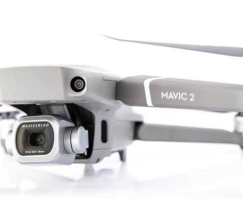
We use multi-rotor drones and have the ability to mount our sensors on vehicles.
One of our professionally trained and experienced UAV pilots and surveyors will carry out a LiDAR survey for the mapping of land, property and infrastructure. LiDAR surveys enable us to produce Digital Terrain Models which is often unachievable with photogrammetry methods, especially around vegetated areas.
LiDAR gives the operator the ability to rapidly survey both small-scale and large-scale areas in a more cost-effective way. A LiDAR system can often be much safer to use when surveying areas such as highways, railway lines and powerlines. A mobile mapping system eliminates any risks during the survey and can allow data to be captured remotely.
Aerial & Mobile LiDAR surveys are ideal for:
- Land surveys
- Forestry and wooded environments
- Quarries & Open cast mines
- Highways
- Urban planning
- Civil structures
- Onshore & offshore windfarms
- Flood zones for flood modelling
- Tunnels & shafts
- Coastlines
- Rock faces
South West Surveys also has the ability to offer SLAM (Simultaneous Localization and Mapping). In layman’s terms this allows us to mobilize our LiDAR system in GNSS denied environments such as cave systems, mines, dense tree covered sites like woodlands, and inside buildings and warehouses.
With the ability to attach our system on a UAV, car, boat, backpack or even in handheld configuration, you’ll be assured we will capture every part of your project, to a high level of accuracy.
Services we offer:
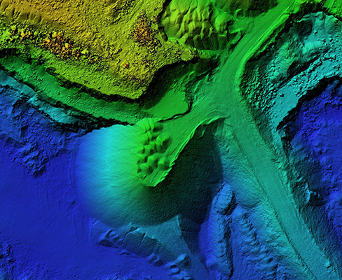
- 3D pointcloud
- 3D pointcloud classification (ground, buildings, vegetation, poles & signs, power lines, tunnel envelope)
- 3D vector models of buildings (up to LOD2)
- TIN
- DEM
- DTM
- Contours
- Shaded surfaces
- Orthomosaic
- Auto extract lines, points & features for CAD
- Monitoring for marine, coastal or flooding
- Volume & area calculations
Not all lidars are equal:

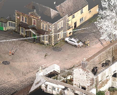
In the world of quickly evolving survey technology, the availability of UAV lidar is becoming more accessible. Whether you decide to use South West Surveys or not please don’t fall into the trap of using cheap inaccurate lidar data. South West Surveys use high end lidar sensors coupled with an extremely highly accurate IMU (heading 0.0071°, pitch 0.0021°, roll 0.0021°), which can give us accuracies of up to 10mm, and when this is joined with our stringent post processing workflow, we can also hugely reduce the pointcloud noise or “fuzz” (please see image for a visual example). Our system can achieve 700,000 points per second and allows for dual return meaning we can potentially achieve up to 1,400,000 points per second!
With the ability to attach our system on a UAV, car, boat, backpack or even in handheld configuration you’ll be assured we will capture every part of your project and to a high level of accuracy.