Utility Surveys
Utility Surveys
South West Surveys offer utility surveys for customers across the UK.
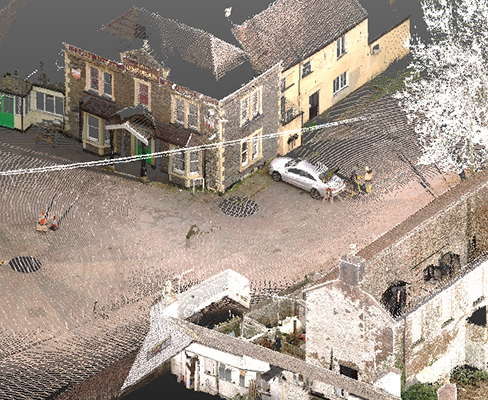
We can offer full utility mapping surveys, drainage surveys & CCTV inspections, utilising the latest ground penetrating radar (GPR) and electromagnetic location (EML) equipment technologies.
Our surveys include, but are not limited to, accurate depth and location data for cables, pipes, ducts and drainage routes which will be positioned to OSGB36 and ODN height.
Utility surveys can be plotted on top of a new or existing South West Surveys topographic survey, or as a stand-alone service.
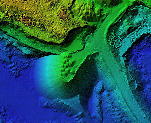
Our utility surveys can also be provided as a 3D DWG file or as a Revit model.
In some cases when a full utility survey isn’t required, South West Surveys can also offer a desktop utility survey. We can source relevant records from utility providers and supply this information in a single document.
For an additional cost, we can provide coal mining and tin mining reports.
Services we offer include:
- Desktop Utility surveys
- Utility mapping
- PAS-128
- Ground penetrating radar (GPR)
- Drainage surveys
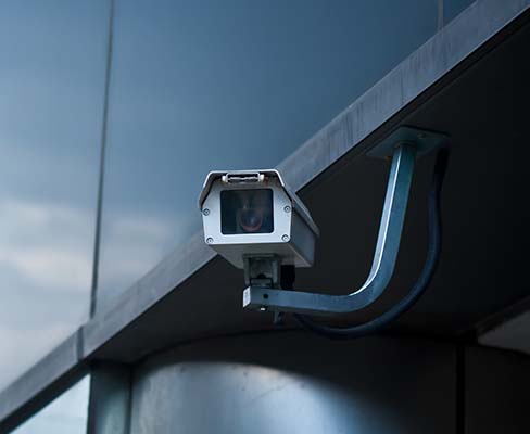
- CCTV Surveys
- Jetting
- 3D utility surveys
Quality level of survey outputs (normative)
| Survey type (establish with client prior to survey) | Quality level (Practitioner to determine post survey) | Post-processing | Location accuracy | Supporting data | ||
| Horizontal 1) | Vertical 2) | |||||
| D | Desktop utility records search | QL-D | - | Undefined | Undefined | - |
| C | Site reconnaissance | QL-C | - | Undefined | Undefined | A segment of utility whose location is demonstrated by visual reference to street furniture, topographical features or evidence of previous street works (reinstatement scar). |
| B | Detection 3) | QL-B4 | No | Undefined | Undefined | A utility segment which is suspected to exist but has not been detected and is therefore shown as an assumed route. |
| QL-B3 | No | +500mm | Undefined (No reliable depth measurement possible) | Horizontal location only of the utility detected by one of the geophysical techniques used. | ||
| QL-B3P | Yes | |||||
| QL-B2 | No | +250mm or +40% of detected depth whichever is greater | +40% of detected depth | Horizontal and vertical location of the utility detected by one of the geophysical techniques used. 4) | ||
| QL-B2P | Yes | |||||
| QL-B1 | No | +150mm or +15% of detected depth whichever is greater | +15% of detected depth | Horizontal and vertical location of the utility detected be multiple 5) geophysical techniques used. | ||
| QL-B1P | Yes | |||||
| A | Verification | QL-A | - | +50mm | +25mm | Horizontal and vertical location of the top and/or bottom of the utility. Additional attribution is recorder as specified in 9.2.5. |
Quality level of survey outputs (normative)
Quality level (Practitioner to determine post survey)
QL-D
Post-processing
-
Location accuracy
Horizontal 1)
Undefined
Vertical 2)
Undefined
Supporting data
-
Quality level (Practitioner to determine post survey)
QL-C
Post-processing
-
Location accuracy
Horizontal 1)
Undefined
Vertical 2)
Undefined
Supporting data
A segment of utility whose location is demonstrated by visual reference to street furniture, topographical features or evidence of previous street works (reinstatement scar).
Quality level (Practitioner to determine post survey)
QL-B4
Post-processing: No
Location accuracy
H: Undefined V: Undefined
Supporting data
A utility segment which is suspected to exist but has not been detected and is therefore shown as an assumed route.
QL-B3
Post-processing: No
QL-B3P
Post-processing: Yes
Location accuracy
H: +500mm V: Undefined (No reliable depth measurement possible)
Supporting data
Horizontal location only of the utility detected by one of the geophysical techniques used.
QL-B2
Post-processing: No
QL-B2P
Post-processing: Yes
Location accuracy
H: +250mm or +40% of detected depth whichever is greater V: +40% of detected depth
Supporting data
Horizontal and vertical location of the utility detected by one of the geophysical techniques used. 4)
QL-B1
Post-processing: No
QL-B1P
Post-processing: Yes
Location accuracy
H: +150mm or +15% of detected depth whichever is greater V: +15% of detected depth
Supporting data
Horizontal and vertical location of the utility detected be multiple 5) geophysical techniques used.
Quality level (Practitioner to determine post survey)
QL-A
Post-processing
-
Location accuracy
Horizontal 1)
+50mm
Vertical 2)
+25mm
Supporting data
Horizontal and vertical location of the top and/or bottom of the utility. Additional attribution is recorded as specified in 9.2.5.
1) Horizontal location is to the centreline of the utility.
2) Vertical location is to the top of the utility.
3) For detection, it is a requirement that a minimum of GPR and EML techniques are used.
4) Electronic depth readings using EML equipment are not normally sufficient to achieve a QL-B2 or higher.
5) Some utilities can only be detected by one of the existing detection techniques. As a consequence, such utilities cannot be classified as a QL-B1.


Contact Us Today
Use our form to estimate the initial cost of renovation or installation.